.jpg)
.jpg&action=info)
.jpg)
.jpg&action=edit&redlink=1)
.jpg)
Nile River Delta (MODIS 2020-06-19).jpg
Från Skolbok

Storlek på förhandsvisningen: 716 × 599 pixlar. Andra upplösningar: 287 × 240 pixlar | 573 × 480 pixlar | 918 × 768 pixlar | 1 223 × 1 024 pixlar | 2 447 × 2 048 pixlar | 2 677 × 2 241 pixlar.
Originalfil (2 677 × 2 241 pixlar, filstorlek: 348 kbyte, MIME-typ: image/jpeg)
Sammanfattning
| Beskrivning |
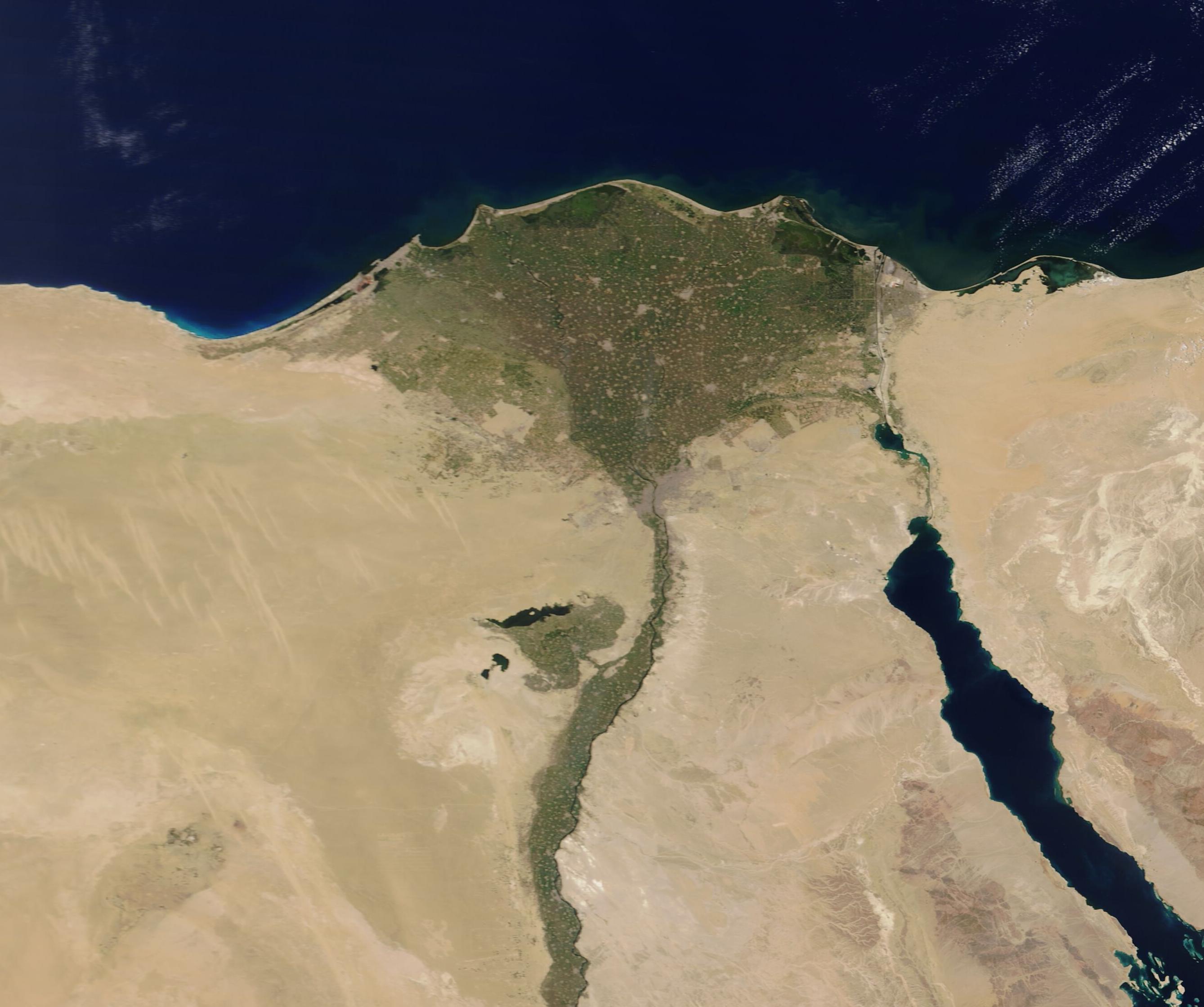
English: On June 15, 2020, the Moderate Resolution Imaging Spectroradiomter (MODIS) on board NASA’s Terra satellite acquired a stunning true-color image of the green Nile River and Nile River Delta against the background of arid tan sands. The Nile is the longest river in the world, extending for about 6,700 kilometers (4,163 mi) from its headwaters in the highlands of eastern Africa to the broad Delta along the Mediterranean Sea.
Roughly 95% of Egypt’s population lives within 20 km (12.4 mi) of the Nile River and its delta, while vast areas of the country remain sparsely populated or uninhabited. The teeming population competes for the oasis-like Nile landscape with agriculture. Only 3.6% of Egypt’s land is considered suitable for agriculture – and almost all that is all located close to the Nile and Nile Delta. According to the Food and Agricultural Organization of the United Nations (FAO), Egypt's total agricultural crop production has increased by more than 20 percent in the past decade. During the same period, the rate of population growth has increased at a slightly higher rate than the increase in crop production. |
||
| Datum | Bild tagen: 15 juni 2020 | ||
| Källa |
Nile River Delta (direct link)
|
||
| Skapare | MODIS Land Rapid Response Team, NASA GSFC |
| This media is a product of the Terra mission Credit and attribution belongs to the mission team, if not already specified in the "author" row |
Licensiering
| Denna fil är allmän egendom eftersom den skapades av NASA. NASA:s upphovsrättspolicy hävdar att "material från NASA inte är upphovsrättsskyddad om inte annat anges". (Se Template:PD-USGov, NASA:s upphovsrättspolicy eller JPL-bildanvändningspolicy.) | ||
 |
Varningar:
|
Filhistorik
Klicka på ett datum/klockslag för att se filen som den såg ut då.
| Datum/Tid | Miniatyrbild | Dimensioner | Användare | Kommentar | |
|---|---|---|---|---|---|
| nuvarande | 17 februari 2024 kl. 03.02 | | 2 677 × 2 241 (348 kbyte) | wikimediacommons>OptimusPrimeBot | #Spacemedia - Upload of http://modis.gsfc.nasa.gov/gallery/images/image06192020_250m.jpg via Commons:Spacemedia |
Filanvändning
Följande sida använder den här filen:
.jpg)